Reports and Presentations
Plans and reports already guide Bethesda Downtown development. The Bethesda CBD Plan outlines the general form for Downtown and has been the official document for the public and private sector since it was approved. Other reports focus in on speciific areas within the Downtown.
This new planning effort requires developing new plan documents and background reports.
Results Are In !!!!!! What did you say your ideal Bethesda should look like? Visual Preference Survey
New - Results - Round 1
New - Results for Round 2
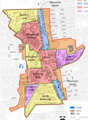
About the survey - For each neighborhood in downtown Bethesda, questions about street character, gathering space, and the types of landscaping for those spaces were presented. While it is not an actual scientific survey, it does provide images that will inform our future discussions about scale and height. The responses will provide us with insights and help guide the look and feel of Bethesda for the next twenty years and beyond. - The survey is now closed
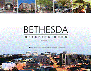
Bethesda Downtown Plan Briefing Book Just Released
This compact but comprehensive review covers where Bethesda has been in terms of history and development and outlines today's conditions, from historic resources, to transportation, parks, and environment to demographics.
Download Briefing Book (40MB).
Contents:
- Existing Conditions
- Historic Resources
- Social and Cultural Resources
- Transportation and Access
- Environment
- Parks, Open Spaces and Trails
- Urban Design
- Landuse and Development
- Demographics
- Economic and Market Data
- Plans and Policies
- Planning Framework
- Additional Studies
Presentations
See the slide presentation from the May 17th workshop
Here is the link. BDP May 17 Workshop Presentation . Find out about the draft Framework Concept, and the current staff thinking on Parks and Open Space, the Environment, Complete Streets and Urban Design and Street Character!
March 1st Workshop - Recap
Over 130 people attended a workshop on the Bethesda Downtown Plan. Watch the short recap video below to find out what happened at this event hosted by the Montgomery Planning Department. Here are the maps and drawings used by the participants to answer four questions:
- What do you want to be able to Bike to in Downtown Bethesda?
- Where should there be more Green Space in Downtown Bethesda?
- Where is it Most Difficult to Cross the Street in Downtown Bethesda?
- Where is the Heart of Downtown Bethesda?
Their answers will help to inform the recommendations of the plan. There are also drawings prepared by each of fourteen small groups. They are being used to inform our work creating several big picture alternatives. Those alternatives will be provided for community discussion as a next step.


