Great Seneca Science Corridor Master Plan archive
back to main plan page
Welcome to the Great Seneca Science Corridor (GSSC) Master Plan Background and Plan Development page. This page contains information regarding past meetings, actions and history of the Plan's Development.
Master Plan Vision
The Master Plan envisions -- and zoning will help implement -- a future LSC that includes an expanded, first-class medical center, research facilities, academic institutions, and an array of services and amenities for residents, workers, and visitors. It will have an open space system that incorporates the area's natural environmental features into a larger network, connecting destinations by paths and trails, and providing opportunities for a range of outdoor experiences.
Transforming today's suburban, auto-oriented LSC into tomorrow's walkable, vibrant science center requires changing the built environment and the mix of uses over time. The Corridor Cities Transitway (CCT) – a 14-mile system that will run from the Shady Grove Metro Station to Clarksburg – is a centerpiece of the Master Plan's vision. The LSC of the future will be served by this fully integrated transit system that links the LSC Districts as well as mid-County activity centers in Rockville and Gaithersburg. The Master Plan includes a rigorous staging element that ties development to implementation of the CCT, including funding, construction, and operation of the transit system. The GSSC Master Plan:- Plans for science and the future growth of the Life Sciences Center
- Provides a blueprint for the Belward property, the vacant, 107-acre site owned by Johns Hopkins University (JHU)
- Recommends relocation of the Public Safety Training Academy (PSTA) and reuse of this prime site within the LSC for a new residential community with supporting retail and open spaces
- Allows for more uses within the LSC to create a vibrant, dynamic, walkable place
- Recommends realignment and new station locations for the Corridor Cities Transitway to place the transit where redevelopment and new development is planned
- Provides general, area-wide recommendations for the enclaves and areas outside the LSC, where the Plan recommends minimal changes.
Planning staff were featured on Montgomery Plans in July 2010. Watch as Nancy Sturgeon, GSSC lead planner and Jacob Sesker, planner/economist discuss the future for GSSC, which includes a new, lively mix of jobs, housing and services -- all built around the life sciences and connected by a proposed light rail or rapid bus system. To view the interview, please click here.
The Great Seneca Science Corridor Master Plan updates the 1990 Shady Grove Study Area Master Plan and portions of the 1985 Gaithersburg Vicinity Master Plan. In addition to the Life Sciences Center, the Master Plan includes the areas west of Quince Orchard and Longdraft Roads, as well as several enclaves -- geographic islands within the County's jurisdiction but surrounded by a municipality. Enclaves include the National Institute of Standards and Technology (NIST), Londonderry/Hoyle's Addition, Oakmont, Rosemont, Washingtonian residential and the Washingtonian light industrial park. View a map of the planning area.
The City of Gaithersburg is an incorporated municipality with its own planning and zoning authority and its own Master Plan. Planners from both jurisdictions coordinate on issues where the planning areas meet.
View the full Gaithersburg West Appendix.
The Master Plan Process
Planners develop master and sector plans to create a framework for each community designed to last 15 to 20 years. Those visions help planners and policy-makers – such as the Planning Board and County Council – make policy and decide on proposed development. Each plan includes an inventory of land uses and an analysis of zoning, transportation, community facilities, environmental assets, and historic structures, among an inventory of land uses and an analysis of zoning, transportation, community facilities, environmental assets, and historic structures, among many other elements.
Created nearly 40 years ago, Montgomery County's General Plan defined the land use concept "Wedges and Corridors," a regional plan that envisioned growth corridors radiating from Washington, D.C., like the spokes of a wheel. In between each spoke, wedges of open space, farmland, and residential areas prevail. Areas served by transit - such as routing the Corridor Cities Transitway through the Life Sciences Center - provide opportunities for vibrant, compact, walkable communities.
GSSC Past Meetings
2009/2010 County Council Hearings and Worksessions
- May 4, 2010: County Council approves Great Seneca Science Corridor Master Plan
- 2010 Council Meetings
- May 4
- April 27 (LSC zone)
- April 13
- April 6
- 2009/2010 County Council Planning, Housing and Economic Development (PHED) Committee meetings:
- April 5
- March 22
- March 15
- March 10
- February
- November 9 | Council Staff Report (LSC zone)
- October 29 | Council Staff Report (LSC Zone from Council Staff report, Oct 26) | Planning Staff Presentation
- October 26 | Council Staff Report | Planning Staff Presentation
- October 12 | Council Staff Report | Planning Staff Presentation
- October 5 | Council Staff Report (LSC zone)
- September 29 | Council Staff Report | Planning Staff Presentation
- September 15 and 17, 2009: County Council public hearing
2009 Planning Board Worksessions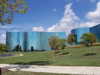
- July 31, 2009: Planning staff transmitted the Planning Board draft to the County Council and County Executive
- July 16, 2009: The Planning Board approved its draft of the Gaithersburg West Master Plan
- June 11: Economic analysis, implementation and staging
- May 28: LSC districts, LSC zone, environment
- May 18: LSC districts
- May 14: CCT, LSC Districts, LSC zone, LSC design guidelines
- April 23: Transportation
- Thursday, March 26: Public Hearing before the Planning Board
Staff presentation
Public hearing testimony (20 MB) - Thursday, February 12:
Planners took the preliminary draft of the Gaithersburg West Master Plan to the Planning Board.
Staff presentation (1.8MB) summarizing the draft plan
Community meetings
A series of community meetings were held to gain public input. The presentations and feedback follow.
- March 18, 2009: Presentation
- December 2, 2008: Presentation and comments from break-out groups
- November 12, 2008: Presentation and comments from break-out groups
- November 6, 2008: Agenda
- October 29, 2008: Presentation
October 2, 2008 Status Report to the Planning Board
Staff report, attachments
Presentation
Recording (Item 4)
February 28, 2008 Status Report to the Planning Board
Staff report
Presentation
back to main plan page