Montgomery County
Planning Department
2425 Reedie Drive, 14th Floor
Wheaton, MD 20902
Planning Department
2425 Reedie Drive, 14th Floor
Wheaton, MD 20902
October 2011
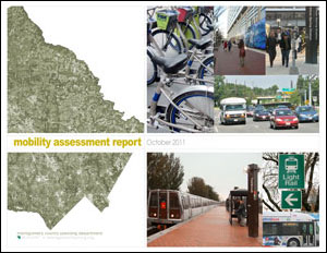
Montgomery County’s traffic congestion has remained at the same level for the past two years, according to the Mobility Assessment Report, a bi-annual study by county transportation planners that monitors local transportation trends. The mobility assessment, which also measures transit ridership, bike use and pedestrian activity, finds that the county’s network of roads continues to be strained by increasing numbers of residents and commuters relying on cars as their primary means of travel.
 Full resolution file (pdf, 20.5 MB)
Fast download version (pdf, 2.8 MB)
MAR appendix (pdf, 5.27MB)
The report ranks the county’s most congested intersections based on critical lane volume data gathered between 2008 and 2011. Critical lane volume data reflects a snapshot of intersection performance, literally capturing traffic volume at a particular time and place.
The top 10 most congested intersections are based on traffic counts at signalized intersections throughout the county. Most of the intersection locations are along major north-south or east-west arterials in the county.
Ranking |
Intersection Name | Count Date | CLV | LATR STandard | Policy Area | ||
|---|---|---|---|---|---|---|---|
| 2011 | 2009 | 2008 | |||||
| 1 | * | * | Old Georgetown Rd at Democracy Blvd | 6/9/2009 | 1923 | 1550 | North Bethesda |
| 2 | Darnestown Rd at Riffle Ford Rd | 3/12/2009 | 1898 | 1450 | North Potomac | ||
| 3 | * | * | Shady Grove Rd at Choke Cherry Ln | 5/19/2010 | 1853 | 1500 | Rockville City |
| 4 | 2 | 5 | Rockville Pike at W Cedar Ln | 11/7/2010 | 1826 | 1600 | Bethesda/Chevy Chase |
| 5 | 5 | 18 | Georgia Ave at Norbeck Rd | 1/22/2009 | 1816 | 1475 | Aspen Hill |
| 6 | 6 | * | MD 355 at Edmondston Dr | 3/12/2008 | 1810 | 1500 | Rockville City |
| 7 | 29 | 1 | Great Seneca Hwy at Muddy Branch Rd | 1/4/2011 | 1800 | 1450 | Gaithersburg City |
| 8 | 9 | 4 | Connecticut Ave at Jones Bridge Rd | 5/13/2009 | 1769 | 1600 | Bethesda/Chevy Chase |
| 9 | 11 | * | E Gude Dr at Crabbs Branch/Cecil | 3/24/2009 | 1742 | 1475 | Derwood |
| 10 | 3 | 10 | Randolph Rd at New Hampshire Ave | 1/13/2011 | 1729 | 1475 | Fairland/White Oak |
The county’s network of roads is strained by increasing numbers of residents and commuters relying on cars as their primary means of travel. Recent planning efforts address new transportation options, such as a better network of roads, expanded transit, bike paths and sidewalks, to achieve more sustainable – and less congested – communities. Moreover, building more homes near transit will create more opportunities for people to avoid driving.
The 2011 report finds that ridership on Metrorail has remained steady, with close to 2 million passengers in fiscal year 2010. Both Metrobus and Ride On Bus have showed slight declines, attributed to reduced service. Yet, Ride On’s extensive network of 80 routes averages 87,990 weekday passenger boardings.
Planners have analyzed pedestrian activity in a limited set of intersections using comparison studies provided by traffic consultants and the State Highway Administration. The fledgling pedestrian database shows higher pedestrian counts in Silver Spring, Bethesda and Wheaton. Future assessments will reflect better pedestrian data collection in the county’s urban areas.
As bikes become more widely used, planners have developed a bicycle map that highlights areas of greatest demand for cycling.
Jaesup Lee, Functional Planning & Policy Division
301-495-4720
jaesup.lee@montgomeryplanning.org
Date of last update: October 13, 2015
Date of last update: November 29, 2011