» Back to: » Planning home » Transportation home » Bikeways
Bikeways
Bicycling is an important mode of transportation in Montgomery County. This webpage displays all of the master-planned bikeways in an interactive map, contains links to relevant master plans, and provides links to recently completed planning efforts.
Bicycle Master Plan
On July 1, 2015, the Planning Department will begin working on a comprehensive update to the 1978 Master Plan of Bikeways. The bicycle master plan has been updated numerous times since it was first approved in 1978, with the last major overhaul occurring in 2005 with the approval of the Countywide Bikeways Functional Master Plan. Click here to get more information about the ongoing update to the Bicycle Master Plan.
What's New!
- Metropolitan Branch Trail
The Planning Board reviewed the plans for the Metropolitan Branch Trail on May 19, 2016 and sent these comments to MCDOT Director Al Roshdieh. See the staff report.
-
 Planning Department Launches Bike Stress Map
The Bicycle Master Plan team has evaluated over 3,500 miles of roads and trails in the County to determine the amount of traffic stress that people experience when bicycling on roads and trails in Montgomery County. The map is intended to help planners understand impediments to bicycling and to identify and prioritize the changes that are needed to create a low-stress bicycling environment for the 50 percent of adults who say they would be interested in bicycling, but do not currently ride because they are concerned for their safety. View the map.
Planning Documents
-
Connecticut Avenue Cycle Track Concepts
This study uses the latest research and best practices to develop concepts for a cycle track on the east side of Connecticut Avenue in the vicinity of the planned Connecticut Avenue Purple Line station.
- See a recap of the Montgomery Planning City Cycling Class
- Bicycle Planning Guidance
This report will assist planners in selecting bicycle facilities as part of the master planning process and for evaluating bicycle facility plans. It provides a pre-screening tool for identifying bicycle facilities that are most appropriate under different combinations of traffic speed and traffic volume. It also provides a Level of Traffic Stress (LTS) methodology that assigns road segments and intersection crossings a level of traffic stress from highest to lowest, permitting an evaluation of network connectivity.
- An Assessment of Purple Line Corridor Bicycle and Pedestrian Issues
Assesses the engineering plans for the proposed Capital Crescent Trail between Bethesda and Silver Spring and the bicycle and pedestrian around planned Purple Line stations in Montgomery County.
- Silver Spring Bicycle Parking Station Study
Evaluates future demand and potential locations for a bicycle parking station near the Silver Spring Transit Center.
Find a Bikeway
Transportation planners have mapped the existing and proposed bikeways and existing hard surface park trails. This map is a policy map and is not intended as a bicycling map of Montgomery County. Click here for the full screen version.
Updated: July 2014

*Existing non-master plan bikeways are striped.
Bikeway Classification
Bikeways in Montgomery County are planned at two geographic levels:
- Countywide Bikeways: Provide connections to major destinations: municipalities, central business districts, town centers, employment centers, transit centers, and regional parks and trails. They function as the skeleton of the County’s bikeway network. Countywide bikeways are identified in both the 2005 Countywide Bikeways Functional Master Plan and local area master plans and are designated as shared use paths (SP), bike lanes (BL), signed shared roadways (SR) and dual bikeways (DB).
- Local / Neighborhood Bikeways: Provide important connections from Countywide Bikeways to community facilities such as schools, libraries, community and recreation centers and local retail centers. Identified as part of community master plans and sector plans. They are identified in Area Master Plans and Sector Plans and are designated in a variety of ways: B, EB, L, LB, and PB.
Several bikeway classifications are used in Montgomery County:
- Shared Use Path: A paved path that is typically 10 feet wide but can vary between 8 feet and 14 feet wide, designated for bicycles and pedestrians, that is separated from motorized traffic by a curb, barrier, or landscape panel. These facilities may be located within a roadway right-of-way (a sidepath) or within an independent right-of-way (such as the North Bethesda Trail).
- Bicycle Lane: A portion of a roadway which has been designated by striping, signing and pavement markings for preferential or exclusive use of bicyclists. Consists of a 4 ft to 6 ft lane in each direction, with traffic flow.
- Separated Bike Lane (also known as a protected bike lane or cycle track): a bikeway that is physically separated from motor vehicles and pedestrian facilities. The separation may be vertical, such as a curb; horizontal, such as a landscape panel or plarking lane; or a combination. A separated bike lane may be in a one-way or two-way configuration.
- Buffered Bike Lane: a bike lane separated from a motor vehicle travel lane with an area of striped pavement.
- Signed Shared Roadway: A roadway open to both bicycle and motor vehicle travel. This may be an existing roadway, street with wide curb lanes, or road with paved shoulders. Types include wide outside curb lanes, bikeable shoulders, and low volume / low speed streets.
- Dual Bikeways: A roadway that features two types of bikeways: 1) shared use path and bike lanes, or 2) shared use path and shared roadway / travel lane. The dual bikeway accommodates both on-road and off-road bicycling along the same roadway.
Countywide Bikeways Functional Master Plan
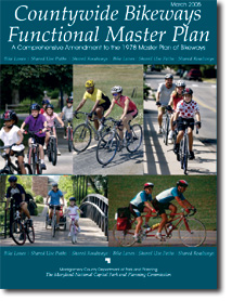 The 2005 Countywide Bikeways Functional Master Plan was the first comprehensive update to the County's bikeway master plan since 1978. The plan focuses on Countywide Bikeways, those bikeways that provide connections to major destinations: municipalities, central business districts, town centers, employment centers, transit centers, and regional parks and trails and that function as the skeleton of the County’s bikeway network. Learn more
Purple Line Functional Plan and the Capital Crescent Trail

In March 2009, the County Council approved a the Purple Line Functional Plan that recommends changes to the Capital Crescent Trail, a shared use path between Silver Spring and Bethesda. Download the approved and adopted Purple Line Functional Plan ), a series of recommendations for the proposed transit line’s route, mode and stations. Learn More.
Bicycle Heat Map
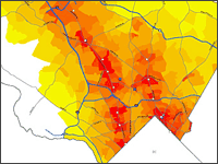 Transportation planners have prepared a Bicycle Heat Map to help the Planning Board and other policy-makers prioritize where to invest in bicycle routes and support facilities. The tool predicts where demand for bike commuting, errands, or other non-recreation trips is greatest. Learn more
Intercounty Connector Bikeway
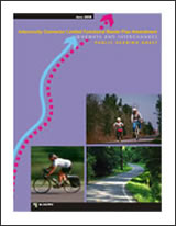 In March 2009, the County Council approved the Intercounty Connector Limited Functional Master Plan Amendment: Bikeways and Interchanges -- also known as the ICC Bikeway Plan. View the approved and adopted plan(4.2 MB).
The plan creates a hiker-biker trail along the general route of the Intercounty Connector from Shady Grove Road to the Prince George’s County line. The trail (SP-40 in the Countywide Bikeways Functional Master Plan) has long been identified in County master plans as part of the proposed ICC.
M-NCPPC Staff Contact
David Anspacher
Functional Planning and Policy Division
david.anspacher@montgomeryplanning.org
301-495-2191
Date of last update: January 20, 2015
back to top