Montgomery County
Planning Department
2425 Reedie Drive, 14th Floor
Wheaton, MD 20902
Planning Department
2425 Reedie Drive, 14th Floor
Wheaton, MD 20902
"Most of all, this Fairland of the future is a livable suburban community - a series of neighborhoods with sidewalks and street trees, access to the natural environment and recreational facilities with employment and commercial areas emphasizing horizontal rather than vertical structures. There is plenty of green space, jobs, shopping, and, most importantly, a variety of housing options to serve a variety of needs and households - the young couples just starting out, single adults, families who need room, older couples who want less space, and senior citizens who want to be able to participate in community life."
From the Plan Vision, Fairland Master Plan (1997), p.15
 Section 1: Cover, Notice to Readers, The Master Plan Process, Contents
Section 2: Plan Highlights
Section 3: Introduction, Background, Plan Framework
Section 4: Land Use and Zoning
Section 5: Transportation, Community Facilities
Section 6:
Environmental Resources, Historic Resources and Preservation
Section 7:
Implementation, Reference Materials
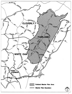
Two areas within the Fairland Master Plan area that have been recently updated:
Please check those pages for the latest information. 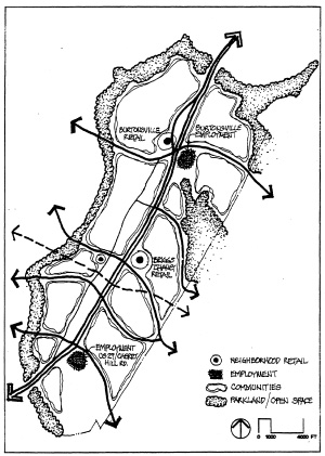
Scroll down to the bottom of Area 3 page for Staff Contact
Date of last update: July 24, 2015