2009 Highway Mobility Report
 The 2009 Highway Mobility Report provides a snapshot of patterns of mobility and traffic congestion in Montgomery County. This year’s report confirms most of our 2008 findings, especially that vehicle congestion is greatest in down-county areas such as Silver Spring, Wheaton and Bethesda. The Planning Board and policy-makers like the County Council will use the report to make decisions about lane, intersection or crosswalk improvements while reviewing development applications. Planning staff use this list to help inform decisions about suitable locations for congestion relief via the Capital Improvement Program (CIP).
We continue to find that priority roads such as Georgia Avenue, Connecticut Avenue and Veirs Mills Road experience the highest congestion and should be targeted for relief.
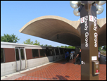 For the first time, this year’s report analyzes public transportation -- Metrorail and Montgomery County’s Ride-On bus system -- and pedestrian activity. Reflecting national trends, planners found a 5-percent increase in Metrorail ridership between February 2006 and February 2009. Metrorail ridership was highest at those stations located amid a mix of houses and businesses, such as Silver Spring. Ridership for the county's Ride-On buses yeilded the highest average ridership in fiscal year 2006, which occurred between Germantown and Rockville, Silver Spring and Langley Park and Shady Grove/Montgomery County to the National Naval Medical Center.
The 10 Most Congested Intersections
The top 10 most congested intersections are based on traffic counts at signalized intersections throughout the county. Most of the intersection locations are along major north-south or east-west arterials in the county. View a map of the Top 10 Most Congested Intersections.
| Ranking | Intersection Name | Count Date | CLV | Latr Std. | Policy Area | ||
|---|---|---|---|---|---|---|---|
| 2009 | 2008 | 2006 | |||||
| 1 | 6 | * | Shady Grove Rd at Midcounty Hwy | 3/5/2008 |
1894 |
1475 |
Derwood |
| 2 | 5 | 2 | Rockville Pike at W Cedar Ln | 1/7/2008 |
1883 |
1600 |
Bethesda/Chevy Chase |
| 3 | 10 | * | Randolph Rd at New Hampshire Ave | 3/26/2009 |
1834 |
1500 |
Fairland/White Oak |
| 4 | * | * | Connecticut Ave at Plyers Mill Rd | 4/28/2009 |
1825 |
1600 |
Kensington/Wheaton |
| 5 | 18 | 12 | Georgia Ave at Norbeck Rd | 1/22/2009 |
1816 |
1500 |
Aspen Hill |
| 6 | * | 56 | MD 355 at Edmonston Dr | 3/12/2008 |
1810 |
1500 |
Rockville City |
| 7 | * | 46 | Connecticut Ave at Randolph Rd | 1/8/2008 |
1804 |
1600 |
Kensington/Wheaton |
| 8 | 11 | 22 | Veirs Mill Rd at Twinbrook Pkwy | 2/3/2009 |
1771 |
1550 |
North Bethesda |
| 9 | 4 | 7 | Connecticut Ave at Jones Bridge Rd | 3/19/2009 |
1769 |
1600 |
Bethesda/Chevy Chase |
| 10 | * | * | Rockville Pike at East-West/Old G'town | 2/6/2007 |
1745 |
1800 |
Bethesda CBD |
| * Unranked either because data was unavailable or Critical Lane Volumes (CLV) did not exceed standard | |||||||
Key Findings
- National and regional trends indicates a decline in travel and congestion since 2006. It's less prevalent in Montgomery County, due in part to the fact that the County has weathered the economic effects of the nationwide recession better than many others.
- While auto travel has decreased slightly during the current recession, public-transportation travel has increased with total Metrorail boardings in Montgomery County 5% higher in 2009 than in 2006.
- The County’s travel conditions in 2009 are similar to last year's.
- The report recomments mobility improvements for priority roadways such as Connecticut Avenue, Georgia Avenue and Norbeck Road.
- The Growth Policy's definition of rush hour (7-9 p.m. weekdays) remains appropriate.
- The number of pedestrians, crossing intersections, is greater along streets with high public-transportation.
Highway Mobility Report Jargon Busters
Below are six terms with definitions, commonly used in the Highway Mobility Report. If you don't know these terms, click on the question mark near each word to find out what they mean.
- Capital Improvements Program (CIP)
- Critical Lane Volume (CLV)
- Local Area Transportation Review (LATR) standards
- Global Positioning System (GPS)
- Arterial Travel Times and Speeds
- Arterial Mobility
Learn more about "Level of Service" by watching this VIMEO video.
Date of last update: August 13, 2009